
Enhanced Heading & Navigation Features
Major improvements to heading display, compass functionality, and map rotation modes for better situational awareness during flight
3 min read
updates
features
+2
We’re excited to announce a significant update to Captain VFR with numerous enhancements based on user feedback and our continuous improvement efforts. This release focuses on making flight planning more intuitive, improving iOS device support, and adding powerful new visualization features.
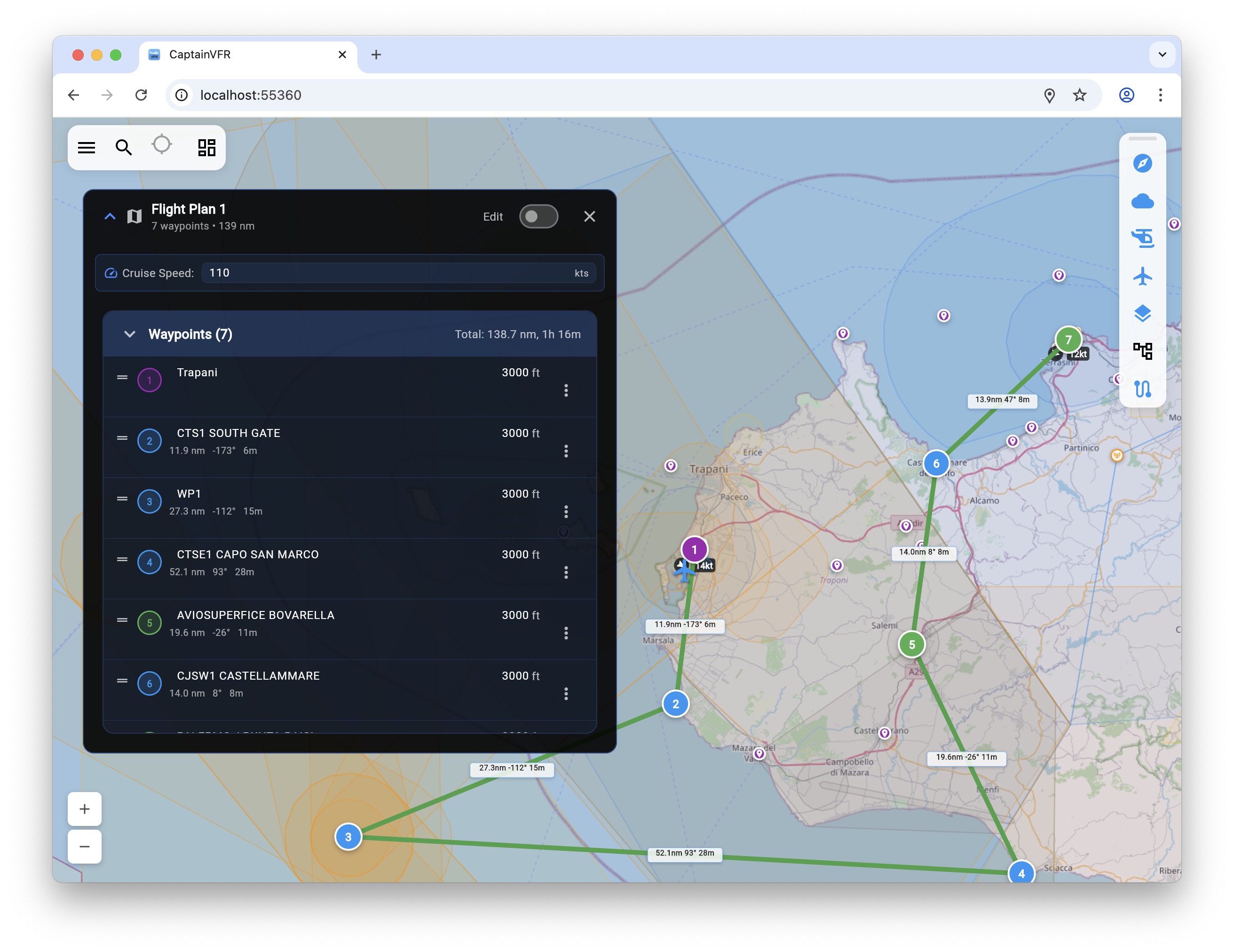
One of the most requested features is now here! You can now insert waypoints directly on your flight path by clicking the green + icons that appear on route segments. This makes it incredibly easy to add waypoints exactly where you need them, with automatic altitude interpolation between existing waypoints.
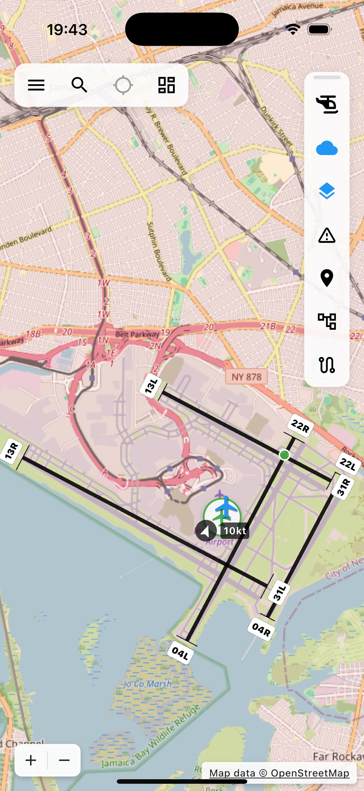
Airports now display detailed runway visualizations at higher zoom levels, complete with designation labels (like “04L”, “22R”). This helps pilots quickly identify specific runways during flight planning and navigation.
We’ve introduced an intelligent runway recommendation system that analyzes current METAR wind data to suggest the best runway for landing. The system calculates:
We’ve completely resolved the map overlay issue that occurred when rotating iOS devices. The map and all UI elements now properly reposition and remain visible after orientation changes.
Enhanced support for devices without barometer sensors (like iPads and simulators), with graceful fallback to simulated data instead of crashes.
We’ve undertaken a major refactoring effort, extracting over 1,300 lines of code from our largest components into reusable, testable modules. This improves:
This release represents our commitment to continuous improvement based on your valuable feedback. We’re already working on the next set of features, including enhanced weather integration, more detailed flight planning tools, and expanded offline capabilities.
Thank you for being part of the Captain VFR community. Safe flying!
Viktor Zeman - Co-founder of CaptainVFR, software engineer, and recreational pilot. Combining 20+ years of software development expertise with passion for aviation to create better tools for VFR pilots.

Explore our comprehensive library of articles, guides, and tutorials to deepen your understanding of key concepts and stay up-to-date with the latest developments.
Major improvements to heading display, compass functionality, and map rotation modes for better situational awareness during flight

Create and manage VFR flight plans with automatic route calculations, waypoint management, and comprehensive flight planning tools
The most comprehensive VFR flight planning application for pilots. Available on Web, iOS, macOS, and Android. Real-time weather, NOTAMs, and advanced flight pla...